

-
Cotton’s Retreat: Land Use Change
For much of the twentieth century, Tajikistan’s lowlands were white in summer. Cotton—pakhta, the “white gold” of Central Asia—dominated every horizon from the Vakhsh Valley to Sughd. Its geometry defined the land: square fields, irrigation canals, and windbreaks in perfect Soviet symmetry. But step into those same valleys today, and the pattern has changed. Wheat,
-
Shrinking Wetlands in Sughd
The wetlands of Sughd are easy to miss. Seen from the road between Zafarobod and Istaravshan, they look like shimmering patches of reeds and shallow water, a blur of green against the gray-brown loess plains. But beneath that surface lies one of the most fragile geographies in northern Tajikistan: a network of seasonal lakes, backwaters,
-
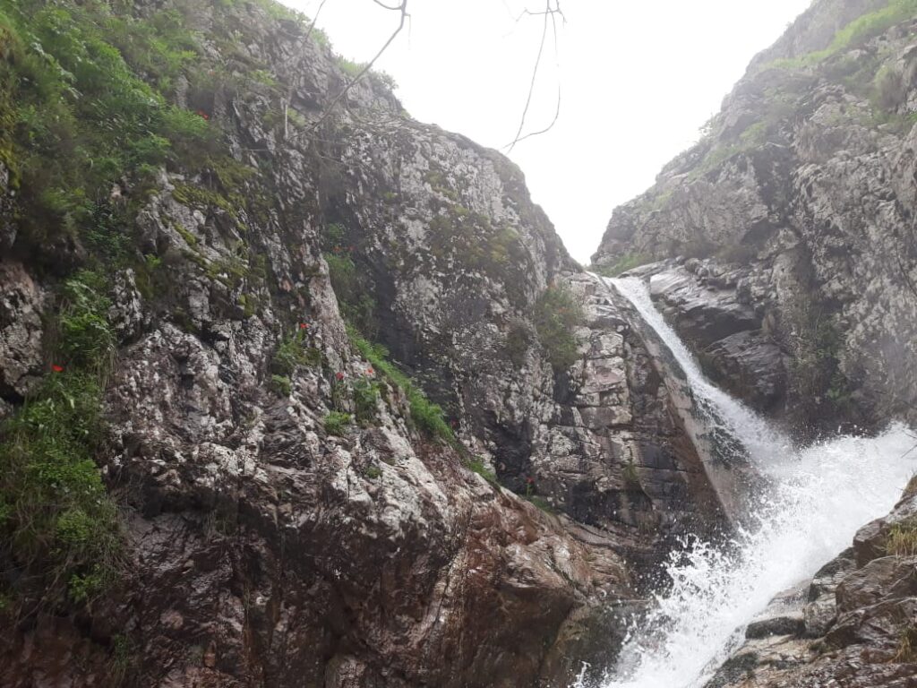
Mountain Weather: Unpredictability Mapped
Mountain weather in Tajikistan is an act of improvisation. Clouds form out of nowhere; snow falls on one slope while sunlight burns on another. The meteorologist’s map is less a forecast than a portrait of volatility. In a country where more than ninety percent of the territory is mountainous, weather is not background—it is the
-
Avalanches and Climate Change
Each winter, as the high valleys of Tajikistan disappear under snow, the country holds its breath. In the Pamirs and the Alay ranges, avalanches descend without warning, cutting roads, sweeping away power lines, and, every few years, claiming lives. They are among the most dramatic expressions of mountain geography—sudden, unpredictable, and amplified by change. For
-
The Vakhsh Valley: Agriculture and Risk
The Vakhsh Valley lies at the center of Tajikistan’s agricultural heartland—a long, sunlit corridor stretching south from the foothills near Danghara to the Afghan border. It is a place of abundance and unease. Here, the geography that makes farming possible also makes it precarious. Fertile alluvial soils spread across ancient river terraces; snowmelt from the
-
Glacial Monitoring: Science on High Ice
At over 5,000 meters in elevation, the glaciers of Tajikistan look eternal. Their white surfaces crown the Pamirs and feed every major river that sustains life below. Yet to scientists who have spent decades measuring them, the ice no longer feels timeless—it feels fragile, restless, and receding. Glacial monitoring in Tajikistan is a story of
-
Soils of the Zeravshan Valley
The Zeravshan Valley winds westward from the icy spurs of the Pamir-Alay toward the plains of Sughd, its river slicing through layers of loess, marl, and glacial debris. To most travelers it looks like a simple thread of green cutting through ochre hills, but beneath that surface lies one of Central Asia’s most intricate soil
-
High Pastures: Yak Herding in the Pamirs
High above the treeline, where the air thins and the land turns to stone and grass, the geography of Tajikistan takes on a slower rhythm. This is the world of the jayloo—the summer pastures of the Pamirs—and of the yak herders who still follow ancient routes through valleys carved by ice and wind. To outsiders,
-
Forest Restoration: Sapling Experiments
Across Tajikistan’s mountain slopes, where Soviet-era maps once painted dense green for juniper and walnut forests, the color has faded. What remains is a patchwork of scrub, stumps, and gullies. Yet in recent years, small rectangles of green have begun to return—sapling nurseries, fenced plots, and reforestation experiments that test how trees might reclaim the
-
Changing Crops: Climate Shifts in Agriculture
In the irrigated plains and terraced valleys of Tajikistan, the geography of agriculture is rewriting itself. The rhythms of water, the timing of frost, and the length of the growing season—once steady anchors of rural life—are slipping out of alignment. Crops are shifting: wheat and barley are moving uphill; apricots and almonds bloom too early;
Search
Archive
- September 2025
- March 2025
- February 2025
- January 2025
- October 2024
- October 2023
- September 2023
- July 2023
- May 2023
- March 2023
- February 2023
- January 2023
- October 2022
- August 2022
- July 2022
- June 2022
- April 2022
- November 2021
- August 2021
- May 2021
- April 2021
- March 2021
- December 2020
- November 2020
- September 2020
- July 2020
- June 2020
- March 2020
- February 2020
- December 2019
- October 2019
- August 2019
- June 2019
- April 2019
- March 2019
- February 2019
- December 2018
- October 2018
- September 2018
- June 2018
- May 2018
- April 2018
- March 2018
- February 2018
- December 2017
- October 2017
- August 2017
- July 2017
- June 2017
- May 2017
- April 2017
- March 2017
- February 2017
- December 2016
- November 2016
- October 2016
- September 2016
- August 2016
- July 2016
- June 2016
- May 2016
- February 2016
Gallery


