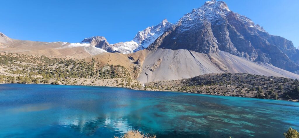
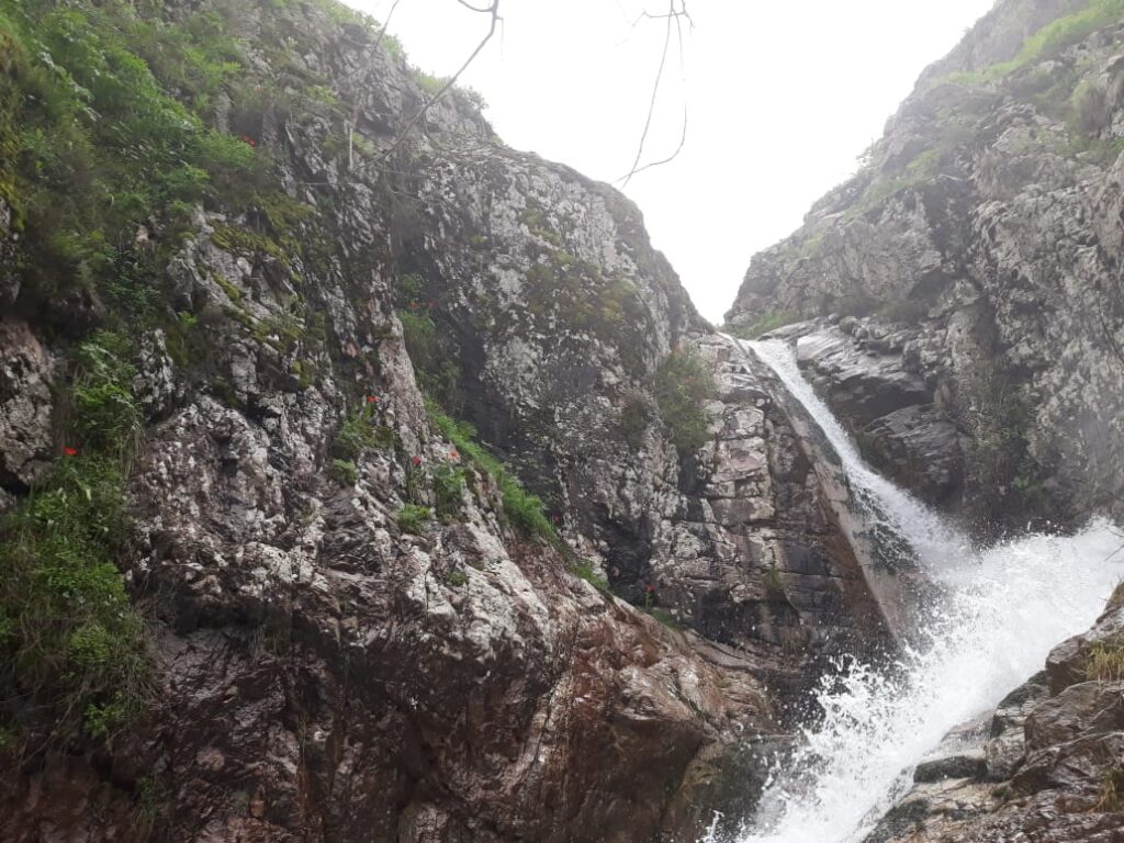
To enter the Yaghnob Valley is to step sideways in both space and time. The road narrows into a dirt track, winding along the turquoise Yaghnob River as cliffs rise steeply on both sides. Occasional suspension bridges sway above the current, linking clusters of stone houses perched on alluvial terraces. At dawn, mist lingers over juniper slopes, and the valley feels suspended as geographically enclosed, culturally distinct, and ecologically vibrant.
Set deep in the Gissar Range of northwestern Tajikistan, the Yaghnob Valley is a classic example of an enclave landscape: a place where topography has created both isolation and preservation. At roughly 90 kilometers long and hemmed in by steep ridges, it is accessible only through narrow gorges and high passes that remain snowbound for much of the year. This enclosure has shaped everything: language, land use, migration, biodiversity, and even historical trajectories.
Geography here is not just scenery; it is destiny. The narrowness of the valley, the steep gradients, the relative remoteness from major transport routes- these physical characteristics have shielded cultural practices, sustained unique ecological zones, and simultaneously limited economic integration. The Yaghnob Valley is a living demonstration of how physical landscapes create cultural and ecological islands within broader regions.
The Yaghnob Valley runs roughly east–west, carved by the Yaghnob River as it drains snowmelt and springs from surrounding high ridges. Geologically, it lies within folded Mesozoic sedimentary rocks overlain by Quaternary terraces and slope deposits (Burtman & Molnar, 1993). The valley floor is narrow, sometimes only a few hundred meters wide, flanked by steep slopes of fractured limestone and sandstone. Active talus cones descend toward the river, making construction difficult and travel slow.
For centuries, this valley morphology acted as both refuge and barrier. The Yaghnob’s side gorges are often steep and narrow, serving as natural chokepoints. High passes to the south and east connect to Zarafshan and Varzob basins, but they are snowbound much of the year. This isolation discouraged large-scale in-migration and preserved a degree of cultural autonomy unusual in Central Asia (Bliss, 2006).
Travelers even today note the abruptness of entry: after winding through steep gorges, the valley suddenly opens to small terraces where fields of barley, wheat, and potatoes cling to every arable patch. Villages hug the base of slopes where springs emerge, while irrigation channels thread through scree to sustain crops during the short growing season.
The Yaghnob Valley is the last stronghold of Yaghnobi, a descendant of ancient Sogdian, the language of a once-powerful civilization that dominated Central Asian trade routes during the first millennium CE. When the Arab conquest and subsequent migrations reshaped the region, the Yaghnob’s remoteness allowed its inhabitants to retain their language and distinct cultural identity (Miller, 1999).
In the 1970s, Soviet authorities forcibly relocated many Yaghnobi families to cotton-growing regions in the lowlands as part of agricultural expansion policies. Yet many returned after independence, reoccupying ancestral villages despite infrastructural challenges. Language persistence reflects geography’s protective role: isolation made assimilation harder, and oral traditions survived in valley enclaves.
One elder in Marghtimayn village explained: “The mountains kept our words safe. Down below, people forgot them. Here, we spoke Yaghnobi to the wind and to each other.” His phrasing is poetic but accurate- linguists note that isolation preserved not just vocabulary but syntax and oral storytelling traditions largely lost elsewhere (Miller, 1999; Bliss, 2006).
The valley is dotted with sacred sites such as springs, boulders, and groves: all often tied to pre-Islamic beliefs layered with Islamic practices. Many shrines are located at geomorphic features: prominent rocks, ridges, or springs, where fault lines intersect aquifers. These nodes anchor collective memory in physical space, linking cultural heritage to landscape features.
Biogeographically, the Yaghnob Valley sits at the convergence of montane forest-steppe and subalpine zones. Its steep elevational gradients create microclimates that sustain diverse flora and fauna. Juniper woodlands cling to slopes; hawthorn and wild rose dot terraces; high meadows support endemic plant species adapted to cold winters and short summers (Nowak et al., 2011).
The river itself supports riparian corridors that contrast sharply with surrounding semi-arid slopes. Springs emerging along fault lines feed irrigation channels and sustain wetlands where birds nest during migration seasons. Small-scale agriculture coexists with these ecosystems in a tight mosaic: fields, pastures, woodlots, and sacred groves often occur within a few hundred meters of each other.
This ecological diversity owes much to the valley’s isolation from intensive agricultural development. Unlike many lowland regions of Tajikistan, Yaghnob escaped large-scale cotton cultivation and dam construction. Traditional rotational farming and transhumance practices persisted, shaped by seasonal water availability and slope stability rather than market imperatives.
A farmer in Nomitkon remarked: “We plant what the water allows, not what the market asks.” His words reflect a landscape-centered logic where hydrology and terrain dictate land use decisions more than external economic pressures.
The Yaghnob River is fed by snowmelt and numerous springs, many emerging from fault-controlled fractures. These reliable water sources determined village placement: settlements cluster near spring lines or where irrigation channels can be gravity-fed to terraces. Fields are typically small and irregular, following the contours of the land rather than imposing grids.
Seasonal flow variability creates both opportunity and risk. In spring, meltwater surges can damage irrigation channels and footbridges; in late summer, flows decrease, forcing careful water-sharing agreements between households. These systems are often managed through traditional institutions rather than formal state oversight (Bliss, 2006).
Importantly, the valley’s hydrology is largely self-contained. Unlike larger river systems in Tajikistan, the Yaghnob’s waters are used primarily within the valley, reinforcing its ecological self-sufficiency. This hydrological enclosure parallels its cultural and linguistic enclosure.
Road access remains difficult. A gravel track follows the valley floor, but landslides and rockfalls frequently block it. In winter, snow and ice make travel hazardous, and some villages remain isolated for weeks. Basic services such as the medical and educational, all require journeys to Ayni or Dushanbe. Yet many families have chosen to remain or return, valuing cultural continuity and ecological familiarity over easier access elsewhere.
Mobile networks have reached parts of the valley only recently, and power infrastructure remains patchy. Some families rely on micro-hydropower units or solar panels for electricity. External development efforts face geographic constraints: steep slopes limit road widening, while fragile ecosystems constrain large-scale interventions.
Geography continues to act as both protector and gatekeeper. The same isolation that preserved language and ecology now complicates integration into national markets and service networks.
For geographers, the Yaghnob Valley exemplifies how landforms create enduring cultural landscapes. Its valley morphology, hydrological autonomy, and ecological gradients generated a distinctive enclave that resisted many homogenizing forces over centuries. Such valleys are not rare in Central Asia, but few have preserved such a strong combination of linguistic and ecological uniqueness into the 21st century.
In the Yaghnob Valley, terrain is not an inert backdrop; it is an active participant in shaping society. The folds of the Gissar Range gave rise to cultural continuity, ecological niches, and hydrological independence. In return, human communities inscribed stories, practices, and pathways that mirror the valley’s contours.
At sunset, the cliffs glow amber, and the river reflects the last light. Smoke rises from stone houses clustered near spring-fed channels. Somewhere up-valley, a shepherd’s whistle echoes against limestone walls. It is easy to imagine how centuries of relative isolation have woven a cultural and ecological fabric here that feels both delicate and resilient.
References
- Bliss, F. (2006). Social and Economic Change in the Pamirs (Gorno-Badakhshan, Tajikistan). Routledge.
- Burtman, V. S., & Molnar, P. (1993). Geological and geophysical evidence for deep subduction of continental crust beneath the Pamir. Geological Society of America Special Paper, 281, 1–76.
- Miller, R. (1999). The Yaghnobi language: Survival of Sogdian. Iran and the Caucasus, 3(1), 43–56.
- Nowak, A., Nobis, M., & Ebel, A. L. (2011). Vegetation of Tajikistan: floristic and plant community diversity. Biodiversity and Conservation, 20(8), 1801–1823.


