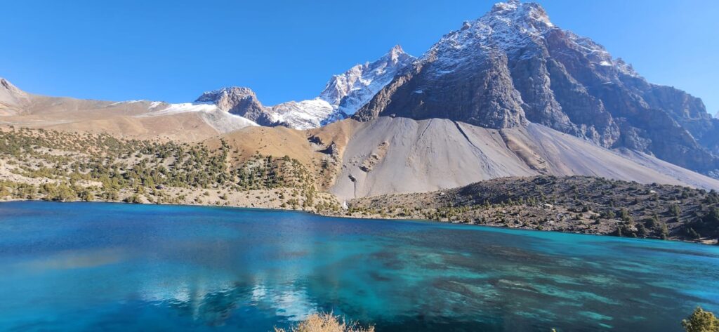
The mountains of Tajikistan rise like walls and altars at once. In the early light, their ridges catch fire before the valleys wake, and their shadows stretch like fingers across rivers and fields. For centuries, people living in their folds have treated certain peaks not only as physical landmarks but as sacred presences: places where earth and sky converse. Sacred mountains in Tajikistan are not hidden temples; they are parts of the lived geography. They structure routes, frame horizons, influence settlement, and give shape to memory.
Tajikistan’s terrain is among the most mountainous in the world: over 90% of its surface lies above 1,000 meters, and more than half above 3,000. The Pamir, Alay, and Gissar ranges intersect and overlap in complex ways, creating steep gradients, enclosed valleys, and dramatic vertical zonation. In such environments, mountains are never merely background. They dictate microclimates, water sources, soil fertility, and accessibility. And they loom. Villages often orient themselves with reference to prominent peaks; herding routes arc around massifs; pilgrimage paths follow ridgelines and saddles shaped by both geology and centuries of foot traffic.
Sacred mountains in Tajikistan emerge at the junction of geomorphology and cosmology. Their sacredness is rarely about monumental architecture; instead, it is encoded in springs that rise at their base, snowfields that feed life downstream, and ridges that catch the first and last light. Geography gives these peaks their physical prominence; society layers them with meaning.
Across the Pamirs and Gissar Range, certain peaks are locally known by names that indicate reverence: Kuh-i-Muborak (the Blessed Mountain), Kuh-i-Aziz (the Dear Mountain), or simply “Hazrat” for sites associated with saints. Many of these are not the highest peaks, but the ones most visibly positioned from populated valleys. In geomorphological terms, they often sit at valley junctions or along main watershed divides: places of visibility and hydrological significance. Springs at their foot become pilgrimage destinations; shrines (mazor) cluster where geology brings groundwater to the surface.
One example lies near the confluence of the Varzob and Sioma rivers north of Dushanbe. Here, a modest limestone peak known locally as Kuh-i-Sioma is believed to protect the surrounding valley from rockfalls and floods. Its slopes host small shrines and prayer ribbons tied to juniper trees. Geologically, the peak’s prominence comes from resistant carbonate strata uplifted along a fault scarp. Socially, its position at a valley gate makes it both a natural lookout and a spiritual guardian. The reverence mirrors the physical dominance.
In the upper Zarafshan valley, Kuh-i-Chiltan rises abruptly from terraced fields. Villagers recount stories of forty saints (chiltan) who prayed on its slopes, and today families visit a spring at its base to make offerings for health. The mountain’s abrupt relief is the result of differential erosion: harder sandstone layers stand above more erodible mudstones, creating cliffs and ledges that appear fortress-like. This physical form reinforces its role as a symbolic protector. Geography and story reinforce each other, each amplifying the other’s power.
The Pamirs hold particularly layered sacred geographies. Peaks like Hazrati Shoh in Shugnan are associated with both pre-Islamic cosmologies and later Ismaili saint veneration (Bliss, 2006). Pilgrims still climb to high pastures where small stone enclosures mark ritual sites. In some cases, these coincide with glacial cirques which amphitheater-like hollows carved by ice, whose dramatic acoustics and visual isolation lend themselves to ritual gatherings. These are not arbitrary choices: glaciers and cirques occupy critical hydrological niches, feeding streams that sustain villages below. The sacredness of the mountain overlaps with its role as a “water tower.”
Quotes from local residents reveal this duality vividly. A herder from Rushan explained, “This peak gives us water and watches us. When the snow melts early, we say it is sending blessings. When it holds the snow too long, we worry.” His words tie spiritual interpretation directly to hydrological rhythms. Another woman from near Iskanderkul said, “We face the mountain when we pray for rain. It listens because it holds the clouds.” In both cases, sacred perception is tied to very real atmospheric and hydrological functions.
These sacred sites are often integrated into landscape use patterns. Seasonal migration routes for livestock frequently pass near sacred springs or ridges. Shepherds may pause at shrines before crossing high passes, asking for safe passage. Settlement placement sometimes clusters near these nodes- not just for symbolic reasons but because sacred springs are reliable water sources, often emerging where fault lines intersect aquifers (Shroder & Bishop, 2010). In mountainous environments, hydrogeology and religious geography are inseparable.
Sacred mountains also function as navigational aids. In areas where valleys are narrow and ridges are labyrinthine, a single prominent peak can orient travelers for dozens of kilometers. Oral traditions often encode these landmarks in storytelling, helping maintain mental maps across generations. A pilgrimage path may double as a transhumance route; a shrine on a ridge may mark a boundary between grazing zones. In this way, sacred mountains help stabilize geographic knowledge in dynamic environments.
Importantly, sacredness does not mean isolation. Some sacred mountains are sites of intense seasonal congregation. Pilgrimages timed with agricultural cycles bring hundreds of people to mountain shrines each spring or summer. These gatherings reinforce social ties between valleys and often align with periods when high passes are open and roads are passable. Thus, sacred geographies are also connective geographies, with moments when remote communities converge at specific topographic nodes.
At the same time, these sites are fragile. Modern road building, quarrying, and hydropower development sometimes encroach on sacred landscapes, altering hydrological patterns or damaging pilgrimage routes. In some valleys, gravel extraction at sacred springs has lowered water tables, leading to both physical and spiritual concerns among locals. The geography that makes these places sacred, their springs, slopes, and visibility are all what makes them attractive for development, creating potential tensions.
Academic studies of sacred geographies in Central Asia emphasize how physical landscapes shape religious practice rather than the other way around (Bernshtam, 1991; Bliss, 2006). In Tajikistan, mountains are so dominant that they act as persistent frameworks for spiritual interpretation across different religious periods- from pre-Islamic beliefs to Sufi practices to modern local Islam. Even when stories change, the peaks remain the same, anchoring human meaning in enduring forms.
At dusk in the Zarafshan valley, Kuh-i-Chiltan casts a long shadow across the terraces. The call to prayer echoes off its cliffs, mingling with the sound of irrigation water running through earthen channels. For the villagers, the mountain is both an old friend and a guardian. For geographers, it is a convergence point: geology, hydrology, topography, and cultural memory meet here in a single massif. Sacred mountains are not abstractions, they are places where physical and social geographies braid tightly together.
“The mountain doesn’t need walls,” an elder in Shugnan once said. “It stands by itself, and we stand by it.”
His statement is not metaphorical flourish but a geographic fact. These peaks stand literally above the valleys, visible from every path and field, shaping weather, water, and the human sense of place. Their sacredness grows from that grounded presence.
References
- Bernshtam, T. A. (1991). Sacred geography and popular Islam in Central Asia. Ethnographic Review, 4, 32–47.
- Bliss, F. (2006). Social and Economic Change in the Pamirs (Gorno-Badakhshan, Tajikistan). Routledge.
- Shroder, J. F., & Bishop, M. P. (2010). Geoinformatics for Geosciences: Applications to the Himalaya. Elsevier.


