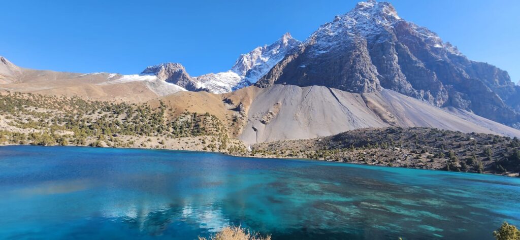
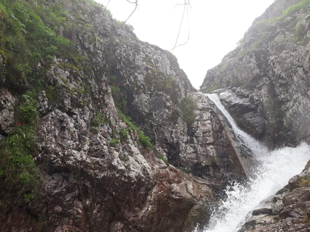
In Tajikistan’s mountains, biodiversity persists in unexpected places: along narrow valleys, across wind-swept ridges, and in the steep transition zones between ecological belts. These landscapes are more than isolated habitats- they form corridors that allow species to move, adapt, and survive in a changing environment. In recent years, scientists and conservationists have turned their attention to these “mountain biodiversity corridors,” recognizing their role in linking protected areas, sustaining genetic diversity, and buffering against climate change. In Tajikistan, where rugged topography meets high levels of endemism, these corridors are as much a geographical phenomenon as an ecological one.
Tajikistan sits at the heart of Central Asia’s mountain systems, with the Pamirs, Alay, and western Tien Shan creating an intricate mosaic of habitats. Elevation gradients are extreme: within less than 100 kilometers, one can move from semi-desert lowlands to alpine tundra above 4,000 meters. This vertical zonation creates ecological belts containing riparian forests, steppe, montane woodlands, subalpine meadows, and alpine zones all stacked like layers on a tilted surface. Historically, species have moved along these belts in response to seasonal cycles and long-term climatic shifts. River valleys, ridgelines, and passes act as natural corridors linking otherwise fragmented habitats.
Biodiversity corridors are not always visible as lines on a map, but they structure how life moves through mountainous landscapes. They follow geography of valleys, slopes, and ridges and their effectiveness depends on the physical connectivity of terrain as much as on formal protection status.
Many of Tajikistan’s protected areas were established to conserve emblematic ecosystems and species, such as snow leopards, Marco Polo sheep, and juniper forests. Reserves like Tigrovaya Balka in the south, the Dashti Jum Strict Nature Reserve, and the Pamir National Park cover diverse habitats, but they are often separated by areas of human settlement, agriculture, or degraded land. Between these reserves lie corridors- sometimes narrow bands of relatively undisturbed land, sometimes broader elevational gradients which allow animals to migrate, disperse, or shift ranges. Snow leopards, for instance, rely on extensive territories that may span multiple reserves, using rugged ridgelines and high passes as movement routes (McCarthy & Chapron, 2003).
Geography determines where these corridors exist and how well they function. River valleys often provide lower-elevation pathways for species moving seasonally between summer and winter ranges. However, valleys are also sites of human activity- settlements, roads and irrigation creating bottlenecks or barriers. In contrast, high ridgelines may offer relatively undisturbed routes but are exposed to climatic extremes and fragmented by glaciers or scree. The configuration of mountain ranges in Tajikistan, with their complex folding and faulting, produces a network of potential corridors that overlap with human land use in intricate ways.
Climate change adds urgency to understanding these corridors. As temperatures rise, species shift their ranges upslope or poleward to track suitable conditions. In mountains, upslope shifts dominate. Alpine meadows climb higher, forests expand into subalpine zones, and species with narrow elevational ranges face “mountaintop extinction” if they cannot move (Grabherr et al., 1994). Corridors that connect lower and higher elevation zones become critical for these movements. A broken or obstructed corridor can trap species in shrinking habitats, while a connected gradient can allow adaptation.
Corridors are the geographic threads that weave isolated reserves into functioning ecological networks. Without them, protected areas risk becoming islands in a warming sea of unsuitable habitat.
Several initiatives have mapped potential biodiversity corridors in Central Asia using remote sensing, ecological niche modeling, and topographic analysis. These studies highlight key valleys such as the Vakhsh, Panj, and Zeravshan as both crucial linkages and zones of vulnerability (Harris et al., 2014). Some corridors follow historical wildlife migration routes that overlap with pastoral transhumance paths, creating opportunities and conflicts between conservation and livelihood practices. For example, Marco Polo sheep migrate seasonally between summer pastures in the Eastern Pamirs and lower wintering grounds. These movements depend on passes remaining snow-free or only lightly covered; changes in snow patterns can block these routes, while road construction can fragment them.
In western Tajikistan, juniper forests occupy mid-elevation slopes, forming belts that connect different mountain blocks. These forests are biodiversity hotspots, supporting numerous bird, insect, and understory plant species. However, overgrazing, fuelwood collection, and land conversion have fragmented these belts in places, narrowing corridors and isolating forest patches. Fragmentation not only reduces habitat area but also disrupts ecological flows of pollinators, seed dispersers, and mobile animals that maintain ecosystem function.
Quoting one conservation biologist working in the Zeravshan Range: “We often think of reserves as fixed points on a map, but species experience landscapes as gradients and pathways. A corridor can be a narrow ridgeline, a riverbank strip, or even a seasonal snowfield. Geography sets the stage, but what happens along these paths determines whether they work.”
Remote sensing and GIS have become essential tools for identifying and monitoring corridor function. High-resolution imagery allows mapping of land cover changes, while digital elevation models help model species movement in relation to slope, aspect, and elevation. Corridor models often integrate “cost surfaces,” assigning resistance values to different land cover types and topographies. In Tajikistan, steep slopes and rugged terrain naturally create high resistance zones for some species but low resistance for others adapted to cliffs and scree.
These analyses are not merely academic. Conservation planning increasingly incorporates corridors into national strategies, recognizing their role in climate adaptation and biodiversity conservation. In Tajikistan, proposed transboundary conservation corridors aim to link protected areas across national borders, particularly in the Pamir and Alay ranges. These efforts align with broader Central Asian initiatives to establish ecological networks that transcend political boundaries (Shultz et al., 2012).
Standing on a high pass overlooking a juniper-covered valley, it becomes clear why corridors matter. Below, forests stretch in uneven bands along slopes, thinning where grazing has intensified. Above, alpine meadows extend toward jagged peaks. Between these zones, wildlife moves unseen, following paths shaped by millennia of geological uplift and climatic fluctuation. These are not static landscapes; they are living networks whose future depends on maintaining connections across complex terrain.
References
- Grabherr, G., Gottfried, M., & Pauli, H. (1994). Climate effects on mountain plants. Nature, 369(6480), 448.
- Harris, R. B., Reading, R. P., Shank, C., & Bedunah, D. J. (2014). Central Asia’s wildlife: Diversity, management, and conservation. Springer.
- McCarthy, T., & Chapron, G. (Eds.). (2003). Snow Leopards: Biodiversity of the world: Conservation from genes to landscapes. Academic Press.
- Shultz, J., Krever, V., & Petelin, D. (2012). Biodiversity conservation in Central Asia: An analysis of biodiversity and current threats. WWF Central Asia Programme.


