At the first light of dawn, the Pamir Highway seems almost empty- just a thin ribbon of asphalt unspooling through rock and sky. A truck grinds up a long incline, leaving a wake of dust and echoes, and for a brief moment the only sound is the wind. From here, where the road cleaves the high plateaus and hugs cliffs above rivers, Tajikistan looks vast, without people, even unreachable. But the road is a thread, and every thread carries stories of connection and isolation at once.
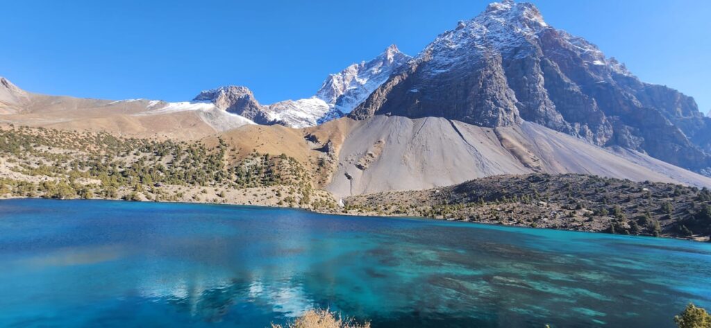
The geography of Tajikistan is famously vertical. Peaks rise above 7,000 meters, valleys plunge deep, and settlements cling to narrow ledges along rivers. Roads here do not flow across open plains; they cut, twist, climb, and sometimes surrender. To travel in these mountains is to negotiate a geography that constantly oscillates between openness and enclosure, between the promise of a pass and the reality of a rockfall.
The idea of “remoteness” is easy to project onto maps: vast white spaces, thin gray lines, few towns. But on the ground, remoteness and connectivity are not opposites- they’re intertwined. Roads both bridge and highlight isolation. A new bridge can halve travel time but also make visible how far everything else still is. A freshly paved highway can accelerate trade while leaving side valleys more peripheral than before. In Tajikistan, road-building is a way of drawing connections on a landscape that resists simple lines.
Remoteness in the Pamirs is not just about distance. It is altitude, season, and slope; it is a landslide that closes a pass for a week; it is the cost of diesel in a village three valleys away; it is whether a doctor can arrive before winter seals the road. Connectivity is equally layered: a truck route that links Khorog to Dushanbe, a track that snakes into a side valley, a footpath that shortcuts where wheels cannot go. Geography makes both real.
The Pamir Highway (M41) is the central spine of high Tajikistan. Built in stages during the Soviet period, it linked Dushanbe to Khorog and then eastward to Murghab, eventually crossing into Kyrgyzstan. Its curves follow river valleys where possible, hugging the Panj, climbing over passes like Khaburabot and Ak-Baital, and sometimes crossing landscapes so austere that the asphalt itself seems improbable. At over 4,600 meters, Ak-Baital Pass is among the highest paved passes in the world. Each ascent brings thin air and expanding horizons; each descent drops travelers into a new catchment, a different world.
Soviet engineers built the highway as a strategic and logistical artery, and its presence transformed settlements along the route. Villages that were once isolated for months gained truck connections; supplies arrived more regularly; students could travel to larger towns for education; medical services became reachable in emergencies (Bliss, 2006). But the road also redirected flows. Trade, information, and migration followed its line, leaving other valleys relatively untouched. The contrast between villages on the highway and those tucked behind a pass is stark even today.
A driver from Rushan once told me, “The road is like a river. If you live beside it, everything flows to you. If you live away, you wait for a long time.” His metaphor is apt. Roads are physical and social rivers. They carry goods, but also expectations, and they reorder landscapes accordingly.
Connectivity, however, is not constant. The same road that brings goods in summer can become an impassable barrier in winter. Snow closes high passes; avalanches sweep across cuttings; spring floods eat away at embankments. Landslides, often triggered by freeze–thaw cycles or heavy rains, can block major routes for days or even weeks. The Pamir Highway is particularly vulnerable in narrow gorges, where slopes are steep and geology is young and unstable (Hewitt, 2011). In these moments, the line on the map dissolves into geography again.
Road maintenance in Tajikistan is a seasonal rhythm. Crews clear avalanches, rebuild washed-out sections, and shore up unstable embankments each spring. In remote stretches, bulldozers and shovels work side by side. Paved sections alternate with gravel patches where winter damage was severe. The persistence of connectivity depends not only on infrastructure but on constant negotiation with terrain.
The smaller feeder roads tell a subtler story. Dirt tracks climb into side valleys like the Bartang or Vanj, sometimes narrowing to a single lane pressed between river and cliff. In many places, these are not “roads” in the conventional sense but tracks maintained by the people who use them: villagers who clear rockfall after storms, drivers who place stones in river crossings. Their connectivity is fragile but vital. In Bartang, where villages are strung along the river for dozens of kilometers, these tracks are lifelines.
Remoteness has always been a relative condition here. Before motor roads, paths and caravan routes threaded the mountains. Shepherds led flocks over seasonal passes; traders carried salt and wool; pilgrims followed trails to shrines. Even now, footpaths and donkey tracks form parallel geographies, sometimes more reliable than roads in winter. They also carry a different kind of knowledge: intimate familiarity with slope, snow, and shortcuts (Bliss, 2006).
The language of “connecting remote regions” often implies that connectivity is something new, bestowed from outside. But in Tajikistan’s mountains, communities have navigated complex terrains for centuries. What changed in the Soviet era and after independence was not the existence of routes but their material form and scale- the difference between a donkey track and an asphalt highway, between a seasonal caravan and a year-round truck route.
Modern connectivity in the Pamirs is shaped not only by roads but by communication technologies. Mobile networks now reach some high valleys, and satellite connections bring global news to isolated settlements. Yet these networks depend on the same geography: base stations must be sited where terrain allows, power must reach towers, and maintenance crews must access them regularly. A broken repeater in winter can mean weeks without signal. The physical geography of remoteness still shapes the digital one (Mostowlansky, 2014).
The tension between remoteness and connectivity also shows up in migration patterns. Roads facilitate seasonal labor migration, enabling young men to travel to urban centers or abroad and return periodically. But the same mobility can drain villages of younger generations, leaving behind altered demographic and labor structures. Connectivity brings opportunity, but also exposes disparities. Not every road leads equally to prosperity.
Geographically, the patterns of remoteness are layered. High passes like Khaburabot and Shurabad act as seasonal gates, their closure schedules almost like calendars. River crossings mark thresholds between regions. Landslide-prone stretches are known to drivers by name, places of habitual caution. Mapping these layers reveals that “remoteness” is less about absolute location and more about networks, nodes, and vulnerabilities.
Road improvements in the 2000s and early 2010s reduced travel times significantly. Asphalt resurfacing, bridge repairs, and some new alignments have made the Pamir Highway more navigable. Yet the fundamental constraints remain: steep slopes, seismic activity, and the sheer remoteness of construction sites. A new bridge can connect a valley, but it cannot move the mountain it spans.
At night, when traffic dies down and frost begins to creep across the road, the silence of the high mountains returns. In those hours, the highway is both a fragile human imprint and a line of enormous significance. Villages wait for morning trucks. Passengers huddle in roadside chaihanas, watching for headlights that signal connection to the wider world.
“The road gives life,” said a shopkeeper in Vanj, “but it also reminds us how far we are.”
That paradox is at the heart of Tajikistan’s high-mountain geography. Roads here do not erase remoteness; they frame it, articulate it, and sometimes deepen it.
References
- Bliss, F. (2006). Social and Economic Change in the Pamirs (Gorno-Badakhshan, Tajikistan). Routledge.
- Hewitt, K. (2011). Rock avalanches that travel onto glaciers and related developments, Karakoram Himalaya, Inner Asia. Geomorphology, 125(1), 49–62.
- Mostowlansky, T. (2014). Roads, remoteness and connectivity: The case of the Pamir Highway. Central Asian Survey, 33(3), 280–296.


