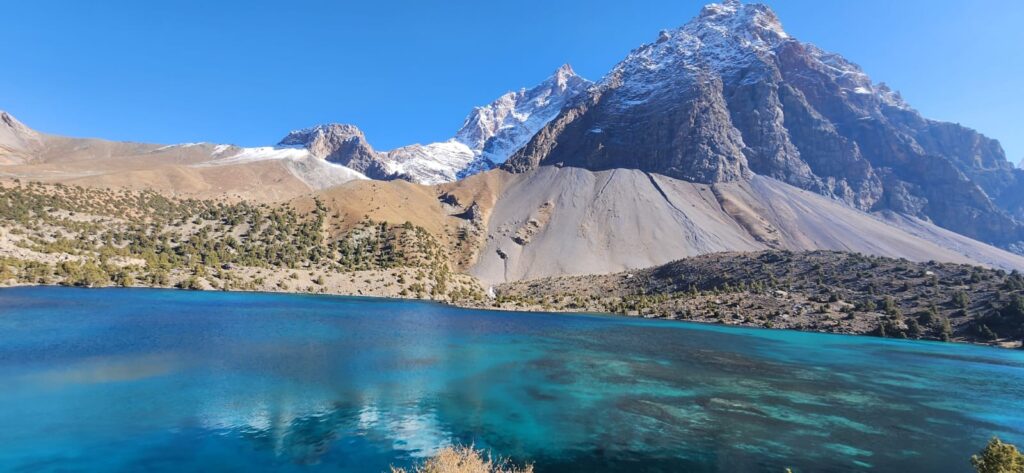
On a clear summer morning in the Pamirs, the first light catches the crest of Ismoil Somoni Peak, casting shadows that stretch across the Fedchenko Glacier. It is a scene at once timeless and fragile. The glacier—one of the largest outside the polar regions—has for generations fed the rivers that make Tajikistan a land of water amidst deserts. But by 2016, even Fedchenko’s vast ice was showing unmistakable signs of change. Scientists, shepherds, and hydropower engineers alike spoke of ice that retreated further each year, of rivers that swelled earlier in the season, and of crevasses opening where once there was smooth snow.
The story of glacier retreat in Tajikistan is not new. Soviet expeditions in the mid-20th century measured the tongues of major glaciers with painstaking accuracy, leaving behind maps and notebooks that now read like warnings from the past. In 1957, the Glaciological Institute in Leningrad noted that “the lower reaches of the Zeravshan glaciers are thinning, with termini retreating by tens of meters each decade” (Kalesnik, 1957). Six decades later, Tajik researchers working with international colleagues could put numbers to what their predecessors observed with tape and theodolite: glaciers across the Pamirs and Alay Mountains had lost between 20 and 30 percent of their area since the 1960s (Shahgedanova et al., 2011).
The evidence was clear. Yet in 2016, glacier retreat was still a paradox: both dramatic and gradual, both visible and hidden.
The View from the Villages
In the high valleys of Gorno-Badakhshan, villagers have always lived with ice. Glaciers were not abstract markers of climate but part of the cycle of farming and herding. In Roshtqal’a, elders remembered when the river ran high only in midsummer, fed by snowmelt. Now, they said, the floods began earlier, sometimes in May. “The water comes too soon,” explained one farmer interviewed in 2015 for a UNDP adaptation program. “We cannot plant in time, and then later there is not enough.”
The glaciers themselves were retreating from the village view. Where children once slid down icy slopes in summer, there was now bare rock. The word yakh—ice—was still common in everyday speech, but more often applied to ice bought for cool drinks in Dushanbe than to the vast white tongues once seen from the valley floor.
To walk near a retreating glacier is to sense time compressed. Rocks that lay hidden for centuries emerge in a single human lifetime. Moraines, once frozen in place, slump and slide. What was yesterday a wall of white becomes today a torrent of gray water, carrying silt that clouds entire rivers. The speed of the change is unsettling, because it unfolds not in geological epochs, but within the span of memory.
Numbers Behind the Ice
By 2016, multiple satellite studies confirmed what villagers described. Between 1960 and 2000, Tajikistan’s glaciers lost roughly one-third of their mass. Some valleys had seen even sharper decline: in the Vanj and Yazgulom ranges, retreat rates exceeded 40 percent (Aizen et al., 2006). Researchers warned that if warming trends of the past decades continued, small glaciers below 3,500 meters would disappear entirely within a generation.
In the language of science, these findings were sober. “Glacier shrinkage in the Pamir-Alay is widespread, with area reductions of 20–30% since the mid-20th century,” concluded Shahgedanova and colleagues (2011). But behind the numbers lay an anxious truth: Tajikistan’s rivers—Amu Darya, Vakhsh, Zeravshan—depend on these glaciers for their very existence. Up to 60 percent of Central Asia’s river flow originates in Tajikistan, earning the country its reputation as the “water tower” of the region. If the glaciers retreated too far, too fast, downstream farmers in Uzbekistan and Turkmenistan would feel the loss as much as mountain herders.
Hydropower and Hazards
Water is not just for crops. It powers the turbines that generate nearly all of Tajikistan’s electricity. In 2016, plans for the massive Rogun Dam dominated national conversations about energy. Proponents spoke of energy independence, critics of environmental risk. Either way, both sides understood that glaciers mattered: without steady meltwater, reservoirs would fluctuate wildly, turbines would falter, and the dream of export power would dim.
There was also a darker side to retreat. As ice thinned, lakes formed where none had existed, dammed only by loose rock and ice. Scientists called them “glacial lake outburst floods,” or GLOFs—a bland acronym for sudden disasters. In the Pamirs, memories of the 1911 Usoi landslide, which created Lake Sarez, haunted discussions of safety. “Retreating glaciers are not only a sign of climate change,” warned a 2016 UNDP hazard report, “they are a source of new risks for downstream communities” (UNDP, 2016).
Science and Symbol
In Dushanbe, the image of glaciers carried symbolic weight. Posters for the International Year of Glaciers in Central Asia showed stylized peaks with blue-white caps. School textbooks described Tajikistan as a mountainous country of ice and water. But for scientists in 2016, symbolism was not enough. What they needed were measurements—mass balance records, remote sensing images, field campaigns. The challenge was not just technical, but financial. With limited resources, Tajik glaciologists relied on partnerships with universities in Europe and Russia, piecing together data sets from Landsat satellites and occasional field visits.
Still, they persisted. “Every year the glaciers retreat,” wrote geographer Abdullo Imomov in 2015, “but our knowledge of the process lags behind. Without investment in science, we are blind to what is happening in our mountains” (Imomov, 2015).
A Regional Story
Tajikistan was not alone. Across the Hindu Kush, the Karakoram, and the Tien Shan, glaciers were shrinking, though at different rates. The so-called “Karakoram anomaly”—areas where glaciers appeared stable—reminded scientists that climate impacts were uneven. Yet the consensus for the Pamirs was strong: warming outweighed snowfall gains.
The regional implications were profound. The Amu Darya and Syr Darya rivers cross borders, carrying meltwater from Tajikistan and Kyrgyzstan to millions downstream. As water allocation had already been a tense subject in Central Asia since the 1990s, the prospect of reduced flows stirred unease. Would countries cooperate, or would scarcity sharpen old disputes?
Living with Loss
What does it mean to live in a country where ice itself is disappearing? For some, it meant resignation. For others, urgency. In Gorno-Badakhshan, teachers took students on excursions to see glaciers “before they are gone.” In Dushanbe, artists painted mountain scenes tinged with melancholy, white caps receding year by year.
Yet there was also resilience. Farmers experimented with earlier planting. Engineers proposed small dams to store excess melt in spring for use later in the summer. Policymakers began to include glaciers in adaptation strategies, though resources were thin.
In the words of one villager near Murghab, quoted in a 2016 field survey: “The ice goes, but the mountains remain. We must learn to live with what is left.”
References
- Aizen, V., Kuzmichenok, V., Surazakov, A., & Aizen, E. (2006). Glacier changes in the Central and Northern Tien Shan during the last 140 years based on surface and remote-sensing data. Annals of Glaciology, 43, 202–213.
- Imomov, A. (2015). Climate and Glaciers of Tajikistan. Dushanbe: Academy of Sciences of Tajikistan.
- Kalesnik, S. V. (1957). Glaciology of Central Asia. Leningrad: Soviet Academy Press.
- Shahgedanova, M., Nosenko, G., Kutuzov, S., Rototaeva, O., & Khromova, T. (2011). Glacier shrinkage and climatic change in the Russian Altai since the mid-20th century. Journal of Hydrology, 409(1–2), 196–206.
- United Nations Development Programme (UNDP). (2016). Glacial Hazards in Tajikistan: Risks and Responses. Dushanbe: UNDP Tajikistan.
- World Health Organization (WHO). (2016). Ambient Air Pollution: A Global Assessment of Exposure and Burden of Disease. Geneva: WHO Press.
