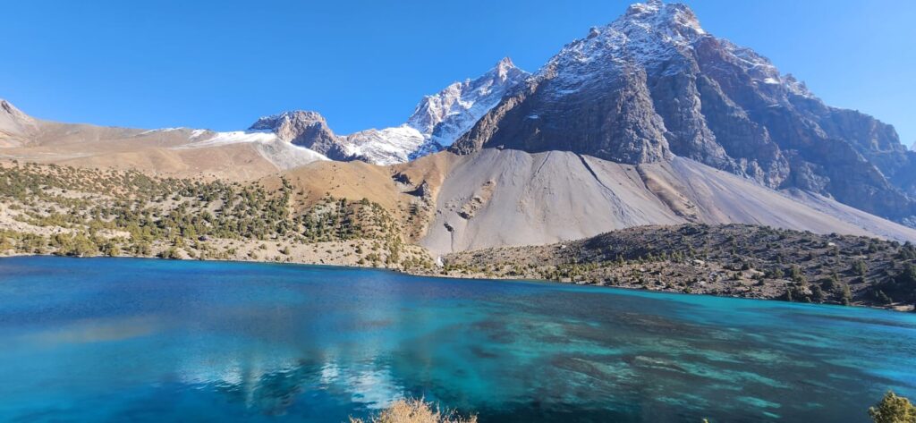
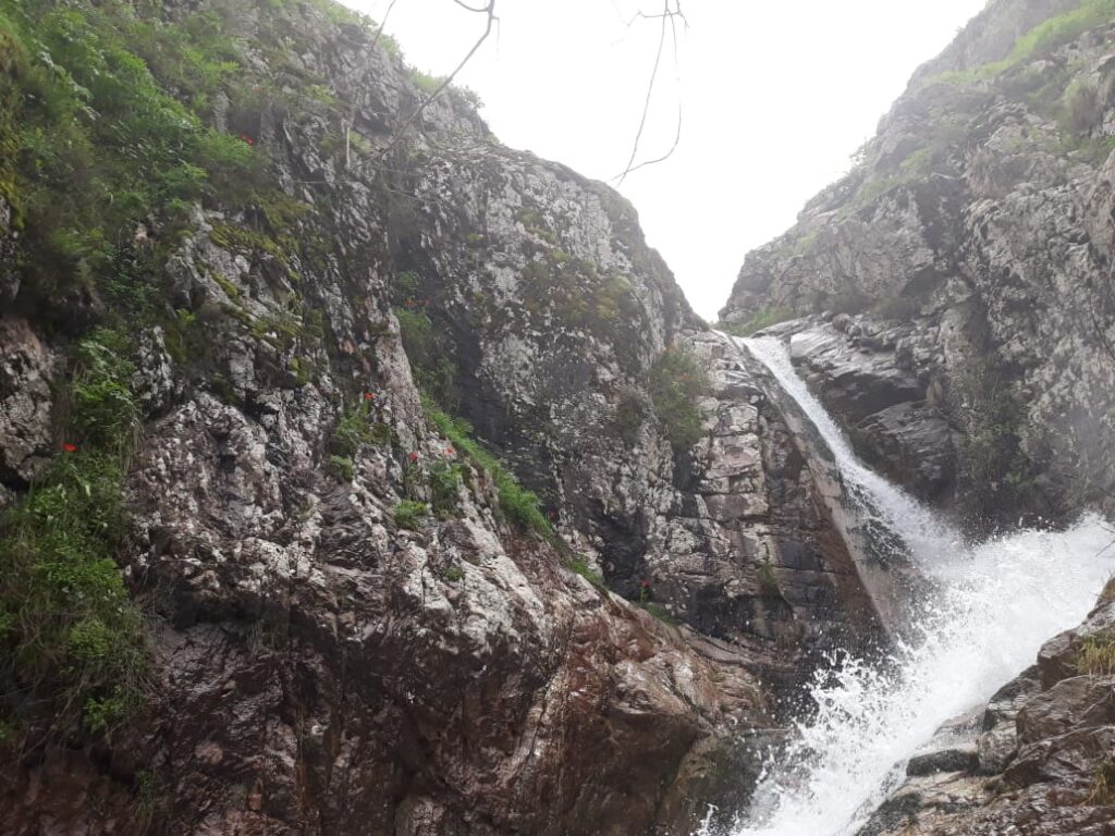
The Gissar Range cuts across central Tajikistan like a rugged spine, a long chain of folded mountains that rises between the fertile valleys of the Vakhsh and Zarafshan rivers. It is not the highest range in the country, nor the most remote, but it is one of the most inhabited and historically shaped by human activity. Its slopes and valleys are where geology and farming have been in negotiation for centuries, each shaping the other in slow, deliberate ways.
Approaching the range from the south, the landscape changes abruptly. Flat agricultural plains give way to undulating foothills, then to steep ridges of limestone and sandstone that fold into a complex series of anticlines and synclines. The Gissar is a textbook example of a folded mountain belt: sedimentary layers once deposited in ancient seas were later compressed and uplifted, producing parallel ridges separated by narrow valleys. In some places, the strata tilt almost vertically, exposing geological time in sharp relief. Farmers have learned to work around these formations, planting crops in flatter synclinal valleys and grazing livestock on ridge pastures.
The geology here is not just scenery. It sets the terms of agriculture: soil types, water availability, slope stability, and microclimate all depend on the structure of the land. Limestone ridges host karst springs that emerge at fault lines, feeding small irrigation systems. Alluvial fans at the mountain base provide deep, well-drained soils suitable for wheat and vegetables. In contrast, steep slopes are prone to erosion if overgrazed or plowed. Farming in the Gissar is a matter of reading the terrain and matching crops to the ground’s physical properties.
The meeting of geology and agriculture in the Gissar Range is a quiet but constant process. Faults, folds, and springs set the parameters, while human labor fills in the details. Fields cling to terraces carved from ancient sediments; irrigation channels trace natural fractures; crops follow soil patterns laid down long before people arrived.
For centuries, villages have been located along spring lines or on river terraces where water and arable land coincide. Springs are remarkably reliable, emerging from aquifers trapped in folded limestone layers. Some are so steady that they have supported irrigation networks for generations without major change. Oral histories often mention particular springs as village landmarks, and farming calendars revolve around their seasonal flow variations. “The spring tells us when to start,” one farmer near Shahrinav explained. “It never lies. If the flow is strong, we know the snow above is melting.”
Traditional irrigation in the Gissar relies on gravity-fed channels cut into hillsides, often following natural contours. Many are centuries old, maintained collectively by villages. They are small but intricate systems: a network of diversions, checks, and small canals that distribute water from springs or streams to terraces below. Because slope gradients can be steep, maintaining stable flow requires intimate knowledge of topography. Erosion control measures of stone walls and vegetative strips are built where channels cross unstable ground. Modern pumps and pipes have appeared in some areas, but gravity irrigation remains widespread because it fits the landscape’s structure.
Geologically, the Gissar Range is young and active. Fault lines cut across its length, and seismicity is common. Landslides and rockfalls occasionally disrupt both roads and fields, particularly where cultivation pushes into unstable slopes. Farmers adapt by shifting plots downslope or reinforcing terraces. In wet years, when snowmelt and rain combine, slope failures are more frequent. A herder near Romit described one such year: “The mountain moved. The fields we built there were buried in a night. We learned not to fight that place again.” These adaptations are part of a long-standing dialogue with a restless landscape.
The soils of the Gissar reflect its complex geology. On limestone and loess-derived fans, soils are deep, calcareous, and fertile, supporting wheat, barley, and orchard crops. On sandstone slopes, they are shallower and more prone to erosion, used mostly for grazing. Higher elevations host thin mountain soils supporting juniper forests and pastures. Over centuries, farmers have expanded terraces into marginal zones, but always with careful attention to slope and soil depth. Terraces are typically dry-stone constructions, rebuilt periodically after heavy rains or slides. In many villages, their maintenance is a communal task tied to agricultural calendars.
Water availability is uneven but predictable. Snowmelt from higher elevations feeds rivers like the Kafirnigan, which cuts through the eastern Gissar in a deep gorge, and countless smaller tributaries. Springs emerging from karst systems are stable through most of the year, but rainfall variability can affect smaller streams. Villages have historically developed sophisticated water-sharing agreements to manage these fluctuations. Some of these agreements are centuries old, embedded in customary law rather than written statutes.
In the Gissar, agriculture is not imposed on the landscape but interwoven with it. The folds and faults shape where fields can lie, the springs dictate planting schedules, and the slopes decide how much labor must be invested to keep soil in place. The result is a landscape where geology remains visible in every furrow and terrace wall.
The Gissar Range also shapes local climate patterns. Valleys aligned east–west trap cold air in winter and channel winds in summer, affecting planting choices. North-facing slopes retain moisture longer, favoring certain crops, while south-facing slopes dry out early and are better for grazing or drought-tolerant plants. Farmers know these patterns intimately. “On this side, the wheat ripens first,” said a villager pointing toward a south-facing terrace. “On the other side, it waits for the longer sun.”
In recent decades, population growth and changing economic conditions have increased pressure on land. Terraces have expanded higher up slopes, sometimes into areas more prone to erosion. Deforestation on lower slopes has reduced natural stabilization, increasing runoff and sedimentation in irrigation channels. Modern inputs such as fertilizers and pumps have altered some traditional practices but have not erased the underlying geographic logic. The terrain still dictates possibilities.
Geologists and geographers studying the region have long noted how human patterns mirror structural geology. Settlements cluster along synclinal valleys; paths follow fault lines; irrigation channels trace karst features. The landscape reads almost like a physical map of its underlying structure. Aerial photographs from the Soviet period show these relationships clearly, with village patterns aligning along springs and terraces fanning out in semicircles below.
At dusk, as the sun sets behind the ridges, the terraces catch the last light, their edges tracing the contours of folded strata. The sound of irrigation water running through stone-lined channels blends with the lowing of livestock returning from the hills. It is a scene that could have taken place a century ago or yesterday. The negotiation between geology and farming continues, quiet but enduring.
References
- Burtman, V. S., & Molnar, P. (1993). Geological and geophysical evidence for deep subduction beneath the Pamir. Geological Society of America Special Paper 281.
- Herrmann, M., & Oberhänsli, R. (2012). Geological structures and geomorphology of the Gissar Range, Tajikistan. Journal of Asian Earth Sciences, 45, 210–223.
- Kassam, K.-A. (2009). Biocultural diversity and indigenous ways of knowing: Human ecology in the Gissar Range. Human Ecology, 37(1), 53–66.
- Stucker, D., & Kazbekov, J. (2010). Irrigation governance in transition: Interactions between formal and informal institutions in Tajikistan. Water Alternatives, 3(1), 100–117.


