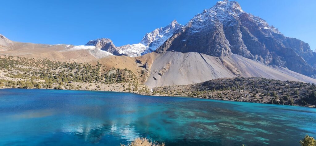
Snow piles deep in the high valleys. Ridges are capped in white. In winter, the silence presses on slopes until a crack, a slide, a roar breaks it. Avalanches are not myths here, but real events, part of the mountain’s language. In the Pamirs, winters carry risk- not just cold, but motion, ground collapse, snow turning from blanket to weapon.
In the Bartang Valley, villagers speak of past winters when snow built high above their rooftops. One elder remembers waking in night to distant rumblings. “I thought thunder,” he says, “but the mountain was collapsing.” The next morning, they found the slope above a terrace sheared, snow and rock buried fields. That memory is geography and narrative, handed down, encoded in wall cracks and scars.
An avalanche begins in steep snowpack. Layers of snow accumulate through storms, wind deposition, freezing and thaw cycles. Weak layersof hoar, sun crusts, facets all form beneath dense snow. Under load, a weak layer fractures. Then gravity pulls the overlying mass downhill. Depending on slope, snow type, and curvature, the avalanche can accelerate to tens of meters per second. In mountain ranges like the Pamir, slope gradients of 30 to 45 degrees are common- ripe terrain. Mitigation is challenging in remote terrain.
Avalanches are geography in motion: snow, slope, gravity playing roles. In those slides lie both scale and suddenness: what seems stable on a calm day overturns in seconds. For people living under snow lines, each winter is negotiation with mass and threshold, with stakes sometimes entire houses and fields.
Avalanches damage more than snow. They scour vegetation, uproot shrubs, slide down to river valleys carrying debris, block channels, and sometimes trigger secondary hazards. An avalanche might block a tributary, forming a temporary dam that bursts later as a cascade of hazards. In the literature on Central Asia, avalanches are documented alongside landslides and glacier detachments as compound risks (Natural Hazards in Tajikistan, OSCE, 2014).
Avalanche paths often intersect roads, trails, villages tucked into slopes. The M41 highway and mountain passes are vulnerable. In 1997, an avalanche on the Anzob Pass between Dushanbe and northern Tajikistan buried vehicles and killed dozens (Anzob Pass disaster). That event remains a stark reminder that even major routes are not immune. Houses built in gullies or at base of slopes often take the brunt.
Communities adapt in subtle ways. Roofs are angled to shed snow. Windows face away from steep slopes. Residents watch snow cracks on slopes after heavy snowfall. In spring, people sometimes shovel snow off roofs to reduce weight. Some place barriers such as wooden fences or piles of rock in order to intercept small slides. But building full defense is costly, and many slopes are too steep or remote.
Climate change aggravates the hazard. Warmer temperatures induce melting, weakening snowpack, increasing water infiltration, increasing weight. More frequent storms and shifted precipitation patterns change snow accumulation dynamics. Studies of high mountain Asia suggest that avalanche frequency and magnitude may increase under warming scenarios (Acharya et al., 2023). In Tajikistan, risk assessments show that many villages lie within avalanche zones mapped by slope, elevation, and historical events (OSCE report, 2014).
Remote sensing helps map potential paths. Satellite data and digital elevation models allow identification of convex slopes, gullies, and trigger zones. Field validation adds to accuracy. These maps show that many avalanche paths originate mid-slope, cross tree lines, and funnel down channels. Overlaying maps with settlement location helps planners mark high-risk zones.
After an avalanche, the silence changes. Debris strews across fields, fences topple, irrigation channels are buried in snow and rock. A village near GBAO reported that a slide cut off their winter water supply, flooding a lower field and rupturing a canal. Repair meant digging through frozen snow, debris, and waiting for thaw. Infrastructure in high valleys is fragile, tied to snow cycles.
To reduce risk, early warning systems are emerging. Some high mountain communities use snow load sensors, simple inclinometers, or tilt gauges. When slopes tip toward failure, alerts go out. But these systems are rare and expensive in remote Tajikistan. Strengthening community awareness by watching cracks, listening for creaks and observing slope change are usually used as the first line of defense.
Tourism and trekkers in the Pamirs must also reckon with avalanche risk. Spring and early summer treks cross snow slopes, glacial basins. Guides carry avalanche probes, choose routes carefully, avoid crossing beneath hanging snow cornices. For them, snow is beauty and peril.
Standing under a slope scarred by past avalanche, one sees geography’s handwriting. The path is clean with trees uprooted, rock guts exposed, snow lines etched. In quiet, the slope above seems pregnant with memory. You imagine snow piling next year, weak layer forming beneath, until threshold breaks again. The landscape is not static, but rewriting.
Avalanches in Tajikistan matter because lives and land intersect snow lines. They are not distant disasters but winter geography, shifting risk into valleys. To map them, monitor snowpack, and plan with slope, elevation, and history in mind, is to lean into the mountain’s voice. Avalanches remind us that in winter, geography speaks rapidly, sometimes with violence, and often with surprise.
References
- Natural Hazards in Tajikistan (OSCE, 2014).
- Acharya, A., et al. (2023). Snow and ice avalanches in high mountain Asia.
- World Bank. (2021). Tajikistan: The Economic Impacts of Disasters along Key Transport Corridors.
- Glacier detachments and rock-ice avalanches in the Petra Pervogo range, Tajikistan (Leinss et al., 2021).
